Tuesday, December 4, 2012

Top Ten Parks Honorable Mentions

To finish this series off, here are a few parks that are well worth your time, but didn't quite make it into my Top Ten.

Glacier Bay National Park is located in southeast Alaska, on the Inside Passage, and features numerous tidewater glaciers. Tidewater glaciers are those that end in the ocean, often spectacularly "calving", which is when large chunks break off and splash into the ocean.


A tidewater glacier as seen from the deck of our ship.

There are no roads that lead to the park, however, many companies offer a boat service to shuttle visitors to and from Glacier Bay. Most visitors, my family included, visit Glacier Bay while on a cruise ship. We took a 7-day Holland America Cruise through the Inside Passage, and our day in Glacier Bay was one of the highlights. Our boat was able to glide up next to the massive glaciers as we were stunned by their truly gigantic size.


Another ship that was in the bay at the same time as us. The ship is many hundreds of feet long and that helps to give scale to the glaciers.
Next up is Rocky Mountain National Park in Colorado. In the movie Jeremiah Johnson, a character named Del Gue says, "The Rocky Mountains are the marrow of the world...and, by God, I was right."

Ypsilon Mountain. NPS photo

This park showcases the beauty of the Rockies in all their splendor. All of the park is over 7,500ft elevation, including many "14ers", those peaks over 14,000ft. Hiking and wildlife viewing are the main draws, with over 330 miles of trails offering visitors the opportunity to view megafauna such as bighorn sheep, elk, mountain lions, black bear, and the occasional moose.


A bull Elk in Rocky Mountain NP. NPS photo
The final Honorable Mention goes to... all the rest. The National Parks ("Our Best Idea" according to filmmaker Ken Burns) are all worth visiting for one reason or another. There are caves (Carlsbad Caverns, Mammoth Cave), coasts (Hawaii Volcanoes, Acadia), forests (Great Smoky Mountains), desert (Canyonlands, Bryce Canyon), swamps (Everglades), mountains (Mt. Rainier, Grand Teton) and so much more that it is impossible to narrow down the list even further.

I haven't been to them all yet, but I think that is a worthy bucket list item. Hopefully I'll see you out there.

Wednesday, November 28, 2012

Top Ten Parks pt 5

I had some trouble narrowing down all of the remaining parks to my final two. As a result, I've picked two, but I'll post one final blog with honorable mentions later in the week.

First up is Olympic National Park in western Washington State. Olympic is often referred to as three parks in one because of the three distinct ecosystems located within the park. The three ecosystems are alpine, coastal, and forest. Olympic is probably most famous for its temperate rainforest.


My brother and I pose for a picture while hiking through the Hoh Rainforest in Olympic.
The Hoh Rainforest has approximately 140-170 inches (12-14ft!!) of precipitation per year. The rainforest is located on the west side of the park. Hiking is obviously the main attraction here, with many miles of trails for visitors to explore one of the only temperate rainforests in the northern hemisphere.

The alpine section of the park contains the Olympic Mountains for which the park is named. Conditions are often extreme in the alpine region, with Hurricane Ridge receiving 30-35ft of snow annually. Despite the harsh climate, a variety of wildlife can be found here.


Me, my dad, and brother at Hurricane Ridge.

The park also protects 73 miles of Pacific coastline where visitors can drive and look at the scenery or hike along the beach for a more hands-on experience. The coast offers many opportunities for tidepooling where you can explore some of the Pacific's marine life. Tidepools form when the tide recedes and marine animals are trapped in small pools until the tide returns. Animals you can find while tidepooling include anemones, crabs, starfish, octupi, various fish, and many more.

For those less interested in wildlife, Olympic National Park is located just a short drive from Forks, Washington, the town depicted in the Twilight Series. The movie was not actually filmed here, although the wild Pacific coast is very recognizable. One of the more distinguishing features of the coast is the presence of sea stacks, which are columns of rock sticking out of the water near the shore. The stacks are sections of the rock that has resisted erosion.

Me and dad and my brother walking along the beach at La Push. While not technically in the park, this is a good example of the Pacific coast. Twilight fans will recognize La Push as being where the werewolves lived in the books and movies.
The final park to make it into my top 10 is...Mesa Verde in Colorado.

As I've said before, there is no such thing as a bad National Park. But to get into the Top 10, these all had something a little extra special, or unique, about them. For Mesa Verde, its the fact that, while there is great natural scenery, the park is more about people.

There are over 5,000 known Ancestral Pueblo (Anasazi) archaeological sites within the park, including 600 cliff dwellings. The name Mesa Verde means "green table" in Spanish, referring to the flat mesa tops where the Anasazi grew corn and other crops. They kept no written records, but is believed that they first settled in the area around 600 AD before leaving around 1300 AD. The cliff dwellings that make Mesa Verde famous were built starting around the late 1100s.

The Anasazi are well known for their pottery and intricate basket weaving, both of which can be found in Mesa Verde's thousands of archaeological sites.

Cliff Palace, thought to be the largest cliff dwelling in North America. The multi-story complex contains over 200 rooms built of sandstone, wooden beams, and mortar. NPS photo
Many of the ruins can be visited on your own through a self-guided tour, but the most spectacular are only accessible through ranger guided tours. When my family visited, we toured both Cliff Palace, pictured above, and Balcony House, below. The trail to reach Cliff Palace requires visitors to climb a series of 5 short ladders to reach the dwelling. The tour last approximately one hour, with the ranger providing interesting information on the Anasazi and their way of life.

Balcony House is much smaller and inaccessible, leading archaeologists to believe it was constructed to be easily defensible. Balcony House contains 45 rooms and is set on a high ledge. The only entrance and exit for the Anasazi is believed to have been a series of  toe-holds in a cleft on the cliff. Visitors now enter by scaling a 32ft ladder and then crawling through a 12ft tunnel. To exit the old Anasazi route is used with the help of two 10ft ladders.

Visitors tour Balcony House with a ranger. The 32ft entrance ladder can be seen on the ride side of the dwelling. NPS photo.
And with that my Top Ten Parks list comes to a close. To recap: Yellowstone, Denali, Arches, Zion, Glacier, Grand Canyon, Redwood, Yosemite, Olympic, and Mesa Verde. With that being said, there are several parks that were close to making the list as well as a few I have not been to. But, like I have said, there is no such thing as a bad park, so if you have a chance to visit one, no matter what or where it is, take it, and enjoy it. 

Monday, November 26, 2012

Top Ten Parks pt 4

For today's edition of my Top Ten Parks let's head out west to California and the parks of Yosemite and Redwood.

Yosemite Valley, with the massive stone monoliths of Half Dome and El Capitan, is one of the more recognizable parks in the country. The smooth granite cliffs make Yosemite a mecca for big wall clmibers, but there is something to do for everyone.

Yosemite Valley with El Capitan on the left and Half Dome in the center background. Google Images

One of the easier trails that is still worth your while is Brideveil Falls. The trail is very short, approximately half a mile round trip, and the falls are spectacular, tumbling 617ft. This is a great hike for families and those looking for a short excursion, but Bridalveil Falls should warrant a visitor from every Yosemite hiker.

The classic "bucket list" trail is Half Dome. Half Dome rises nearly 5,000ft above the valley floor, peaking out at an elevation of 8,800ft above sea level. The 14-16 mile trail (depending on your route) gains 4,800ft of elevation and is reccommended for experienced hikers only. One of the more famous (or infamous) parts of the trail is the final 400ft of cables that allow hikers to summit without rock climbing equipment. If so well prepared, and take the proper precautions, Half Dome is a trail you do not want to miss.

Half Dome at sunset. Google Images
From Yosemite we move to the northwest corner of California to Redwood National Park and the tallest trees on the planet.

Redwood is located on the Pacific coast, offering visitors much more than just tall trees, although that is, of course, the main attraction. There are various scenic drives and hikes throughout the park that offer visitors a chance to gape at the giants.

Yes, there is a tree you can drive through. Google Images

One must actually see a Redwood tree to truly appreciate its size and place as the largest living thing on the planet. These trees range in diameter from 8 to 20 feet and grow as tall as 375ft. That's taller than the Statue of Liberty from the base of the pedastal to the tip of her torch. They also live up to 2,000 years.


A walk through Redwood brings visitors back to the time of the dinosaurs, when these behemoths still stood guard. Google Images
If the trees aren't enough to hold your attention, head out to the edge of the park and the wild Pacific coastline. Here visitors have opporunities for whale watching, beachcombing, and hiking.


Klamath River Overlook
The Klamath River Overlook. Here visitors can look for salmon, seals, sea lions, sea birds and whales. NPS
Come back soon for the final installment of my Top Ten Parks. What are they? You'll have to wait and see. I'm still deciding myself.

Monday, November 19, 2012

Top Ten Parks pt 3

Today's two parks, Glacier and Grand Canyon, are all about size. Visiting these two parks are big on a scale that is hard to describe until you see if for yourself.

Glacier is located in northwest Montana, with the park's northern border being the Canadian park of Waterford Lakes. The name for the park came from, obviously, the numerous Glaciers that fill the mountainous park. I visited Glacier this past summer with my family, and you can read more about my experiences here.

The one absolute must when visiting Glacier is to drive the Going-to-the-Sun Road. We did this on our second day in the park. The road, built in 1932, traverses the entire width of the park, going 32 miles from the west entrance to Logan Pass, and then 18 miles from the pass to the east entrance.

I took this photo from the Highline Trail looking back east towards Logan Pass. Going-to-the-Sun Road is visible snaking along the edge of the mountain on the left side of the photo.
The brilliant road design consists of one long switchback that takes visitors from the valley floor to 6,647ft Logan Pass. This allows spectacular views of the expansive park and beautiful Rocky Mountains.

Other attractions in Glacier include numerous hikes, ranging in difficulty from extremely easy to difficult multi-day backcountry treks. One of the more popular hikes in the park is Avalanche Lake. My mom, brother, and I did this hike on our first day in the park. The trail is fairly easy with only two miles each way and a 500ft rolling elevation gain.

Glacier is probably in my Top 3 parks and definitely one you do not want to miss. As a side note, Glacier's glaciers are rapidly shrinking and retreating as the globe continues to warm. If this trend continues, they may be gone very shortly. All the more reason to find an excuse to visit Glacier as soon as possible.

My mom, brother, and I in front of Avalanche Lake
Next up we have Grand Canyon National Park. One of the most recognizable landmarks anywhere, the Grand Canyon, carved by the mighty Colorado River, is considered one of the seven Natural Wonders of the World. While there are several interesting hikes to take in the canyon, the main attraction here is just seeing something so wonderfully massive.

I found this interesting picture that helps to give an idea of scale. The canyon makes points seem close that are actually many miles away. Google Images
One of the hikes that we did when my family visited was the Rim Trail. This trail follows the South Rim (where most of the hikes begin and the location of most of the lodging) from Hermit's Rest to the South Kaibab trailhead. A shuttle bus runs along the road not too far from the trail and there are stops every mile or so, making the Rim Trail accessible to a variety of hikers.

We chose to take the shuttle to Hermit's Rest and then hike approximately 8 miles back to Rim Village where we were staying. The trail is very scenic with overlooks such as The Abyss where you can look over the edge as the sheer walls plummet more than 3,000ft straight down.

The best time to view the canyon is during the "golden hours". These are the times just after sunrise and just before sunset when the warm light fully brings out the reds and oranges of the canyon.

The canyon during golden hours. Google Images
Despite the crowds, more than 5 million people visit each year, Grand Canyon is easily in the top 10 US National Parks. Since you can see it from space, I think you can make some time to see it in person.

Friday, November 9, 2012

Top 10 Parks pt 2

For the second installment of my Top 10 Parks, let's head to the southwest and the red rock landscapes of Arches and Zion.

Arches National Park is located in southeastern Utah, just a short drive from the town of Moab. The park, true to its namesake, is filled with over 2,000 natural arches as the sandstone has been eroded away. The arches range is size from tiny holes to massive spans such as 290ft Landscape Arch.


My brother and I in front of Landscape Arch

Hiking is the main attraction here, and the park is filled with trails for hikers of all ages and abilities. The most famous hike here is without a doubt Delicate Arch. The iconic image of the park, this
3 mile trail traverses slick rock and is considered moderate, although it may be completed by most hikers willing to take their time.

My brother and under iconic Delicate Arch
My favorite part of Arches is the Fiery Furnace. This labyrinth of canyons and fins is a maze that is usually only attempted on guided hikes. You can choose to explore the fiery furnace alone, but you must apply for and receive a permit, and be very experienced hiking in this type of environment.

We elected to go on the ranger guided hike which lasts 3 hours and is considered moderately strenuous. Between jumping small gaps, wedging ourselves through openings, and holding ourselves over gaps by pressing the canyon walls on opposite sides, the Fiery Furnace was definitely a fun adventure.

The second park in today's segment is Zion National Park, also located in Utah, about 350 miles southwest of Arches.

Zion is a relatively small park, but there is much do to here. One of the more famous hikes is Angel's Landing (you can read about my experiences on that trail here). Another famous spot to hike is The Narrows. This is a section of the canyon where the walls narrow (of course) to as little as 20 or 30 feet while still rising up to 2,000ft off the valley floor. A permit is required to hike the complete 16-mile length of The Narrows because of the constant danger for flash flood, as well things like hypothermia and drowning because the entire length of the hike is spent in the Virgin River.

A hiker in The Narrows. Google Images

Other activities include climbing (for which Zion is a mecca) and canyoneering. There are so many climbers that is seems you can always take out your binoculars and scan a wall and find a few.

Another thing that sets Zion apart is its interesting intra-park transportation system. In an effort to reduce pollution and traffic jams, cars are not allowed within the main portion of the canyon. Instead, several free shuttles run to transport visitors through the length of the canyon. This idea works brilliantly, and also makes it easy on the visitors. You simply get on the shuttle, look at the map to see which stop you want, get off and do your hike, then get back on and ride back to your hotel or campsite.

Zion is small enough that it can be seen in only a few days, but it is definitely a must see among National Parks.

Up next, Glacier and Grand Canyon.

Wednesday, November 7, 2012

Top 10 Parks pt 1

There's no such thing as a bad National Park. There is absolutely something to see or do at every single one. That being said, of course some are better than others, and this is obviously up for debate. However, over the next couple weeks, I am going to give you a list (in no order) of the 10 National Parks that you I think you must visit before you die.

We'll start off with two of the best parks for wildlife with Yellowstone and Denali.

Yellowstone, located in northwest Wyoming, was America's first national park, established in 1872. It is the second largest park in the continental US (behind Death Valley) and is known for its many geysers and hot springs.

Seated on top of one of the largest supervolcanoes in the world, Yellowstone contains over 60% of the world's geysers as well as numerous mudpots and hotsprings. Geysers are holes in the ground through which hot water shoots up from within the Earth. Geysers can range in size from barely breaking the surface, to mammoth waterspouts of several hundred feet.

One of the most famous geysers is, without a doubt, Old Faithful. Located next to the Old Faithful Lodge, it is extremely predictable, erupting roughly every 90 minutes, shooting water an average of 145ft into the air for an average of 5 minutes. The predictability, as well as the impressiveness of the stream, are the main reasons for the enduring popularity of Old Faithful.


Old Faithful staying true to its namesake as visitors look on. Google Images


Another reason for Yellowstone's immense popularity (over 3 million people visit the park every summer) is the quantity and diversity of wildlife, specifically the megafauna. A typical drive through Yellowstone might include sightings of bison (actually, if you don't see a bison you must not have your eyes open) elk, grizzly bears, mule deer, moose, bighorn sheep, and, if you're extremely lucky, you might see the resident pack of gray wolves that lives in the Lamar Valley.

The herd grazes with small geysers and hot springs in the background. Google Images


But if you truly want to see big wildlife, and lots of it, Denali is the place to go.

Denali National Park and Preserve is in the interior of Alaska and is centered around Mt. McKinley (called Denali "The High One" by Native Americans) the highest point in North America.

Like most Alaskan parks, Denali is almost entirely wilderness. There is one road in the park, and only the first 15 miles of this road is open to private vehicles. Therefore, there are really only two ways in which you can experience the park.

The first is by hiking and camping in the backcountry. To do this, you must be extremely competent. Denali allows no room for error, and dangers abound including severe weather and large animals.

The second is by riding the park bus which drives to the end of the park road and back everyday, allowing visitors to see the beauty of Denali. This is what my family and I elected to do when we visited in the summer of 2006.

We had perfect weather, and the animals were out in force. We saw the "Big 5" of Denali in grizzly bears, caribou, a bull moose with a huge rack, grey wolves and their cubs, and Dall's sheep.

A Caribou silhouetted against Denali. Google Images
Because of this incredible variety of wildlife, as well as the spectacular scenery, Denali easily secures its place as one of the Top 10 National Parks.

Check back Thursday for the next two on my list, Arches and Zion in the American Southwest.

Monday, October 29, 2012

What would you do if money was no object?

Came across this video today. It's pretty short (less than 3 minutes) and honestly worth your time. Enjoy.

Trip Planning 101

I think I might have mentioned this in an older post, but this Christmas Break, I'm heading out to Colorado with my brother and some friends for a ski and snowboarding trip. As the de facto leader of our group, it was up to me to plan out the trip. To make the best trip at the cheapest price, I borrowed some tricks learned from my dad, a little bit of my own intuition, and more than a little appreciation for seeing exactly how many people you can fit in a car, hotel room, etc.

We knew that we wanted to go to Colorado, but as to exactly which resort, we had no idea. I began to research our options, taking into account the characteristics of each mountain, the price, popularity (through online reviews) and other such factors. And that is the first major step in planning a successful trip: research.

If you have never been to a place before, how can you know exactly what you want to do? Researching not only helps to clarify this, but sometimes shows you opportunities you hadn't even considered. Patience is also important, because the longer you take to explore all of your options, the better deals you often find.

For a variety of reasons, we settled on Copper Mountain, just west of Denver in the heart of Summit County. Next we had to decide on where we would stay while out west. Our options included both those on the mountain (hotels, condos, etc) and those in smaller towns a short drive away. Once again, research came into play as it became apparent that "ski and stay deals" (in which your lodging and lift tickets are a combo package) would be the cheapest option. However, we still had to choose exactly what type of lodging would be best for us.

In my past experiences, lodging is the single biggest area in which you can save money. Most of the time (at least on trips that I would take/have taken) you are there to see and do things, not to stay in a hotel. Therefore, I see no reason to spend a bunch of money on a luxury suite. Many people look down on budget chains such as Motel 6. I have stayed in Motel 6s around the country and they have all been simple and sparse, yet clean and adequate. We're only there for the night, besides a bed with clean sheets and a bathroom, what else do you really need?

That being said, there are obviously no Motel 6s in the village of Copper Mountain. There are several in Denver, however, and we will be staying in one to give us a stopover on the drive out so we will be fresh when we get to the mountain the next morning.

Food is also a major expense that can be offset with a little bit of planning. Whenever my family goes on vacation, it was understood that when we got to our destination, we would stop at a grocery store, buy a styrofoam cooler and fill it with lunch meat, fruit, and other snack that would become our lunch for the duration of the trip. Eating sandwiches at a picnic area instead of stopping at a probably overpriced restaurant (especially in areas such as national parks where you are a captive audience) is a simple thing to do, yet it can greatly reduce your daily food budget.

With this in mind, we decided on a condo at Copper Mountain, because it comes with a full kitchen. When we traveled to Snowshoe Mountain, West Virginia last year, we also stayed in a condo and cooked and ate our meals there. Doing this is much cheaper that eating at the ridiculously expensive resort restaurants that cater to the extremely wealthy. Similar to last year, we plan to bring cheap foods such as hotdogs, hamburgers, macaroni and cheese, and the like. We even went as far last year as to head out into the woods before we left and bagged a couple of squirrels and doves which we cleaned and brought with us for a meal.

By following these principles, we are going to be able to afford to go out West and ski on a college budget, which we consider a minor miracle. With careful planning and research, eating on as cheaply as possible, and being willing to stay in less than luxury motels, trips can be cheaper than originally thought possible while still being just as fun.

Friday, October 26, 2012

Squirrels

When I first came across this story I couldn't help but laugh. Birth control for squirrels? Really? We did have a mild winter and squirrels are now more than abundant on my college campus but come on. I find it hard to believe that we have come to the point that we need to spend money on squirrel contraceptives.

Clemson University researchers claim that their school spent an estimated one million dollars on maintenance as a result of squirrel damage. As a result, they have begun offering the vermin laced sun-flower seeds, and are currently analyzing the effects of the seeds on the squirrels and their natural predators such as hawks.

I can think of an easier way to eliminate the squirrels, but, unfortunately, shooting them with a .22 is probably not a viable option on a college campus. I have never been hunting for large game, however I have been plinking squirrels since a young age.

When I was in late elementary school, my family's house backed up to a woods and, as a result, our birdfeeders were flocked with a tremendous number and variety of songbirds. As you can imagine, it didn't take very long for the squirrels to figure out where they could find an easy, constant source of food.

One of our feeders was mounted on top of a 4x4 which proved no challenge for the nimble squirrels to climb. We tried slipping an aluminum pipe around the middle of the pole, but this only stymied them for a short while as they soon figured out they could reach the feeder by taking a flying leap from a nearby bush. That left only one option.

Deciding we were too young for a real firearm, my dad bought me and my brother a pump pellet gun. It became a weekly contest to see who could get the most squirrels from our sniper perch in an upstairs window. The challenge was to pump up the gun (it was air powered) as quickly and quietly as possible, slowly (and again quietly) slide the window open, and finally to hit the squirrel. Pellet guns are not particularly powerful so a headshot was usually required for a kill.

This carried on for a few years until we finally got what we then thought was the mother of all firearms, the .22. The challenge of getting the window open quietly still remained, but once we got our sights on the poor vermin it was game over. We went on a killing spree that included my personal record of eight squirrels in barely a week. This slowed them down, but we continued to get a couple a month until we finally moved a few years later.

I hope to someday own a house near a woods, and to be able to put in some birdfeeders. But now, if we get squirrels, I know the first thing I'll do.

Sunday, October 21, 2012

180° South

I was bored on a Sunday afternoon last spring when I stumbled across a movie on Netflix that piqued my interest.

The title was 180° South, and the summary read, "The film follows adventurer Jeff Johnson as he retraces the epic 1968 journey of his heroes Yvon Chouinard and Doug Tompkins to Patagonia."

I knew that Yvon Chouinard was the founder of outdoor clothing and gear retailer Patagonia, and that Patagonia itself was a remote and wild region at the very tip of South America. But I didn't know anything about Jeff Johnson, Doug Tompkins, or any epic journeys.

As you have probably figured out by now, something that says "epic journey" is right up my alley, so of course I decided  to watch it.

Jeff Johnson is a man who has made his life outdoors, working odd jobs, "doing whatever it took to pay for the next big trip." Ten years before this film, he watched "Mountain of Storms," Doug and Yvon's account of their 1968 journey. He knew then that Patagonia was a place that he was going to have to visit.

Did I mention that Doug is also the founder of The North Face? When these two friends and traveling companions finally decided to "grow up" they both founded multi-million dollar outfitting companies.

Fast forward to present day. Jeff has found a stable job and is beginning to settle down. But there is still Patagonia. He could easily take his two weeks and fly down, but that would defeat the purpose. He decides that if he is ever going to make such a trip, now is the time.

Jeff finds a ride, in exchange for his labor, on a sailboat named the Sea Bear that is traveling from California to the captain's native Chile. The trip is going well and Jeff is finally starting to adjust to sea travel when disaster strikes. During his watch, the mainmast is ripped from the hull and snapped like a twig.

Lacking enough fuel to motor all the way to mainland Chile, they head for Easter Island (also known as Rapa Nui) the most remote island in the world and home to the famous stone heads (moai).

I don't want to give away too many spoilers so I'll summarize the rest, but Jeff meets a native girl, Makohe, and she accompanies him for the rest of the journey.

Jeff finally makes it to Patagonia where he meets up with Doug and Yvon who are in the midst of the largest private conservation effort ever undertaken.

Yvon agrees to join Jeff and two of his friends who have flown down to accompany him in his mission to find waves and eventually climb a mountain called Corcovado.

From here the film takes on a different role as it transitions from being purely an adventure epic to a progressive pro-conservation film. Chile, in the midst of an incredible industrialization, is used as an example of what is happening to our world, and why we must try to reverse what we have already done.

It is said that we cannot take a step back, but what if, as Yvon says, "The solution to a lot of the world's problems may be to turn around and take a forward step."

180° South has received criticism for being too preachy and that Doug and Yvon are simply self-centered millionaires who are preserving all of this land as their own personal playground. However, I didn't see it that way. Sure there are some parts that seem a bit treehugger-ish, but its true that we are losing our wild places and if something isn't done, they may eventually be lost forever.

What I took away from the film was allure of open spaces, of the epic trip, of the wild. Jeff Johnson did something that most of us can only dream about. I hope that one day I'll be able to take a few months and just go. Watching Jeff on his journey inspires, and myself, to get out and go.

"Fear of the unknown is the greatest fear of all...but we were just going for it." -Yvon Chouinard

Watch the trailer and learn more about the movie here

Friday, October 19, 2012

Life on the edge (sort of) part 3- Hawaii Edition

When my brother and I turned 13, my dad took each of us on a trip; for me, it was Hawaii. We went over Christmas Break of my 7th grade year and spent just over a week exploring the islands.

The trip started off with us worrying whether or not we would even be able to go as we sat in the airport and watched breaking news of the terrible tsunami that was devastating southeast Asia.

Fortunately, Hawaii was left unscathed and we were off. Our first adventure on the "edge" was in Hanauma Bay on Oahu. We had rented snorkeling gear and wetsuits for the week, and Hanauma Bay was a prime destination.

We simply walked in off the beach and swam to the reef where we were fascinated by the endless schools of colorful tropical fish, especially yellow tangs. There were a lot of yellow tangs. A lot.

We had been swimming around maybe an hour when we saw the pièce de résistance of the coral reef: a sea turtle.

While you aren't technically supposed to approach or follow these endangered animals, of course that is exactly what we did. Staying a respectable distance behind, we followed the turtle as it silently gilded across the reef. We soon lost track of time and distance and, before we knew it, we had swum all the way to the edge of the reef.

Deciding this was probably far enough, we turned around to swim back where we encountered one small problem; the current was pushing us back out to sea.

Fortunately, this was the ocean, so there was an endless supply of waves to push us back in. And so we began the process of swimming against the current, and only holding our own, while waiting for the next wave to give us a boost back towards the shore.

After a while of this we finally made it back to the reef (where we unfortunately suffered a few small scrapes from being pushed across the coral. All in all, Hanauama Bay was awesome, and I couldn't wait for another chance to snorkel.

Towards the end of the week, we were on the Big Island where we decided to snorkel in Kealakekua Bay. The bay is also the spot of the Captain Cook Memorial, the spot where the first English man set foot in Hawaii in 1779 and was subsequently killed. The bay was an excellent spot for his large ocean going ships because it stays deep extremely close to shore.

The memorial is accessible only by water, so we had to rent a kayak. The paddle across the bay was beautiful, and we beached our kayaks by the memorial before donning our masks and flippers and wading out to snorkel.

After snorkeling for awhile (the highlight of which was seeing an eel), we stopped to take a break and eat our lunch. As we were eating we noticed that the weather was beginning to turn so we decided to head back.

As we began paddling the wind started to kick up and soon small swells were breaking across the bow of our tandem kayak. We paddled harder as were we swamped with wave after wave of warm saltwater.

Fortunately, the paddle across the bay is relatively short and we made it just fine. After returning our kayak and walking back to our car I found dried salt on my sunglasses from the evaporated saltwater that had splashed on my face.

Hawaii was one of my favorite place I have visited and I can't wait to go back someday.

Tuesday, October 16, 2012

Mach 1.24

He did it.

Mach 1.24.

833.9 miles per hour.

This past Sunday, Red Bull Stratos skydiver Felix Baumgartner finally jumped from the edge of space, shattering the record books as he fell almost 24 miles before landing safely back on Earth.

It took him just over two hours for him to rise to a final altitude of 128,100ft, but only 9 minutes and 9 seconds to come down. He spent 4:22 of that time in freefall, accelerating to a top speed of 833.9mph (Mach 1.24 or 1.24 times the speed of sound), the highest speed ever reached by a human body. Fortunately, there were no complications as he broke through the sound barrier.

I wrote about Felix and his mission in a previous post, giving background on his goals, equipment, and safety concerns.

Early into the jump, he began to spin rapidly out of control, but was able to quickly correct this without the drogue, preserving his speed and his chance at the record books.

The date, October 24, was 65 years to the day from when Chuck Yeager first broke the sound barrier in a jet.

In addition to the speed record, Felix also set world records for highest freefall and highest manned balloon flight.

This picture, taken by a remote-controlled camera on the balloon, shows Felix as he prepares to jump. This angle gives some perspective as to how high he really was. Although it looks like he is in space, he is technically still in the Earth's atmosphere. He said that is was hard for him to recognize how fast he was falling because of the lack of scale.

Watch the video here. Be warned, its pretty awesome.


Tuesday, October 9, 2012

Red Bull Stratos Cancelled, Again

For what seems like the hundredth time, the Felix Baumgartner's record-breaking freefall from the Red Bull Stratos balloon has been postponed. There was originally a five-hour delay because of a radio failure, and the weather had deteriorated enough to make take-off impossible by the time the radios were fixed. For those that don't know, the Stratos website explains everything much better than I can, but I'll try to give you a quick summary.

The current record height for a parachute jump is 102,800ft, set in 1960 by US Air Force Colonel Joe Kittinger. The goal of the Red Bull Stratos "Mission" (as they are calling it) is to break that record with Austrian Felix Baumgartner jumping from a height of 120,000ft.

The mission is partly for the record, but science hopes to learn from his jump as well. Based on mathematical calculation, Felix's body will break the sound barrier during his freefall, becoming the first human to do so. What exactly will happen to his body when he does, is up for debate.

Other dangers (and attempts to study human physiology at the edge of space) include freezing temperatures (as low as -90F), extreme lack of oxygen, and air pressure so low that blood literally "boils" with vapor bubbles.

To combat this, he will be wearing a full pressure suit, similar to what modern astronauts wear. Also, his capsule that he will ride up in is fully pressurized and heated. His chest pack will contain two bottles of oxygen that contain enough breathable air for 10 minutes at altitude.

Baumgartner in his suit during a practice jump. His highest practice jump was just over 97,000ft, the second highest ever.

To stop his freefall and return him safely to Earth, Baumgartner will wear three separate parachute, designed specifically for the Red Bull Stratos project. The first two are a main chute and a reserve. The third is an interesting device called a "drogue" chute which is designed to stop a flat spin. A flat spin is incredibly dangerous to parachutist because the G forces can either render them unconscious, and unable to pull their chute, or the centrifugal force will be so great that they cannot bring their arms into their body to pull their chute's ripcord. Felix hopes to not have to use the drogue because it will slow him down.

In case something goes drastically wrong, Baumgartner will have a button on his ring finger to deploy the drogue. Also, if his on board computer detects 3.5Gs for 6 continuous seconds the drogue will automatically deploy.

The jump is going to be streamed live on the Red Bull Stratos website, and I was able to watch today until the cancellation. They have yet to announce the date of the next attempt, but it will be shown live as well.

Sunday, October 7, 2012

Freeskiing Basics

As I sit here in central Indiana, winter has arrived out west with several Colorado ski resorts set to open this week. To anyone who has ever skied or snowboarded, the allure of fresh powder so early is tantalizing.

Having just watched The Art of Flight I am even more ready for our first snow. The Art of Flight, called by critics the best snowboarding movie of all-time, features Travis Rice and his crew throwing some of the craziest moves ever attempted on some of the world's gnarliest lines. The film is a little over an hour long and my friends and I have already watched it multiple times.

I've also been spending al ot of time lately on the New Schoolers website. This is a forum-based website where people can discuss the "new school" style of skiing; freeskiing. Like the name implies, freeskiing is completely unrestricted with the only boundaries being the skill and daring of the skier. Subsets of freeskiing include park, pipe, and jibbing.

Park skiing takes place, obviously, in the terrain park. This is a place on a ski resort, usually a shorter run, or sometimes even its own area serviced by its own lift. The park is made up of a combination of jumps, rails, and boxes for the skiers (and also snowboarders) to perform tricks.

Jumps are self-explanatory, but can range in size from small "kickers" to Winter X Games behemoths with 60+ ft gaps. Skiers launch themselves off the jumps into a variety of flips, spins, and grabs. One of the appeals of freeskiing is that everyone can start off with almost no skills and can eventually perform tricks. My best to date so far is a 360 Safety, a maneuver that involves spinning in a complete circle while grabbing the bottom of my ski under my boot.

Boxes and rails are exactly what they sound like, and are platforms for the skiers to slide or "grind" down. This entails turning 90 degrees (or a larger multiple of 90 if you're good) and landing on the rail, keeping your balance, and spinning again to land forwards (or backwards) at the bottom.

Pipe skiing is the most dangerous type of freeskiing, and is therefore only attempted by the most advances skiers. A superpipe is a half cylinder built into the side of the hill that allows the skiers to rocket up and out of the pipe, sometimes as high as 25ft above the lip (and maybe twice that above the bottom of the pipe) while flipping, spinning, and grabbing, before returning back to the pipe, only to launch themselves out on the other side. The injuries in the superpipe are usually severe, and, last winter, Sarah Burke, the best women's pipe skier on the planet, was killed when she hit her head during practice.

Finally, there is jibbing, the favorite activity of my friends and I.  Jibbing takes place on the hill itself, not in the park. As you ski down, you look for natural features that you can grind on (such as ledges or shelves in the snow) as well as little kickers that form, especially in the trees. This style is my favorite because it is all about creativity and no two runs are ever the same. You are constantly looking for new features and new ways to hit them.

Unfortunately for me, winter is still a few months away here in Indiana. But, until then, I will keep reading, watching, and waiting for that magical first snow.

Friday, October 5, 2012

Summer Vacation part 4

Our original plan had been to stay the night in Vancouver, and then get up early the next morning to re-enter the country and catch the ferry to San Juan Island. Like any good trip, however, there were complications.

The World Fireworks Championship was being held that night, which he had been looking forward to. This, of course, drew a large crowd to the city (about 200,000 people from what we were told). I normally am not a huge fan of crowds, but we figured we could take them for one night.

When we got to our hotel in late afternoon (after driving all day) downtown was unbelievably packed. I also began to notice something interesting about the people clogging the streets...most were wearing some sort of rainbow colored clothing. And holding hands. With people of the same sex.

Turns out that weekend was a huge gay pride parade, expected to draw a couple hundred thousand additional people to the city. And our hotel was right on the parade right, smack in the middle of the chaos.

We decided the city was going to be simply too crazy so we cancelled our hotel and set off back to America. Once we got back into the country (and back into free cell phone service) we began calling ahead to the various towns that were near the ferry dock to the San Juan Islands.

Keeping in line with the events of the day, there was a big annual art fair going on and we could not find a hotel anywhere. My brother and I had our phones out, looking up hotels and calling one after another only to hear, "sorry, we're full."

Finally, after more than an hour of searching, we found a rather sketchy motel for the whopping price of around $50 a night. But hey, it was a bed. We got up at 6 the next morning, caught the ferry, and were finally on the island by noon.

This is my family on the ferry. One of the other ferries had broken down so ours had to make additional stops at other islands, almost doubling our time to Friday Harbor, the port on San Juan Island. But that's another story.

Our lodging on the island was a cabin that a local family rents out, and it was absolutely awesome. Their property was set right on the water, away from any main roads or tourist hubs. They had their own private beach (at low tide, anyway) and I was able to go out and sit on the rocks and watch the sunset every night. It was definitely one of the best places we stayed on the entire trip.

The next morning we drove to Roche Harbor, on the northwest corner of the island, we set off on our respective adventures, my brother and I sea kayaking and our parents whale watching. I wrote about our experiences on that trip in a previous post which you can read here. Needless to say, being 30 yards from an adult killer whale in a 17ft kayak is a pretty interesting experience.

We spent our last day on the island exploring the coasts, looking for whales and other marine life, and visiting the historic American and British camps from 1859 when we almost fought the British over a pig (no really, that's the truth, read about it here)

My brother and I just outside the American camp, looking west across Haro Strait. As you can tell from the picture, we had nearly perfect weather.

When our time on the island came to a close, we reluctantly re-boarded the ferry, drove back to Spokane, and flew home.

With my brother and I both in college now, and working during the summers, this was probably our last big family vacation. I'm sure (and I hope) that we will continue to take smaller trips together, but our annual vacations to destinations as far as Alaska and as close as Michigan, will always be one of my favorite childhood memories, and I hope that I can one day give my children an equally memorable experience.

Tuesday, October 2, 2012

Summer Vacation part 3

I'm back, sorry its been almost a week, but I'll get back to my recap of my families vacation last summer.

When I left off, we had just left the United States and headed into Canada. We stayed one night at the famous Prince of Wales Hotel in Waterton Lakes National Park before heading north to Calgary.

Calgary was the host of the 1988 Olympic Winter Games, and we visited the Olympic Park where we were able to see the ski jump and bobsled run. The bobsled run is famous because 1988 was the year of the Jamaican bobsled team, forever immortalized in the movie Cool Runnings.

Later that night we went to eat at Ranchman's Cookhouse and Dance Saloon (supposedly the party headquarters of the Calgary Stampede Rodeo, the largest in the world). As soon as we walked in, my brother and I immediately recognized it as the bar where the Jamaican team got into the fight in Cool Runnings. Sure enough, the Jamaican bobsled and their four yellow helmets were hanging on the wall. Whether or not they actually got in a fight there is a mystery (and probably a Hollywood invention) but that scene was filmed there so that was kind of fun to see.

From Calgary we headed west to Banff, in the heart of the Canadian Rockies. The actual town of Banff surprised me, as I had been expecting a mountain town and it more closely resembled Gatlinburg, TN.

We weren't there for the town, however, and the mountain scenery was spectacular. Specifically, we visited two pristine lakes, Lake Louise and Moraine Lake.


This is my family at Lake Louise, with a glacier in the mountains above us. The water was an incredible turquoise blue color, and Moraine Lake was even more vibrant.

We also saw an abundance of wildlife on the roads in Banff National Park including several grizzly bears, a couple black bears, a moose, and an elk, among others. We only hiked shorter trails while we were here (due to inclement weather) but the wildlife was definitely a highlight.


This was a black bear we saw from our car. Fortunately (or unfortunately, depending on your point of view) this was as close as we got while in Banff.

After a few days in Banff we once again headed west, traveling through Jasper and Revelstoke National Parks. We only passed through those parks, stopping off periodically to do things such as take a short hike or visit a waterfall.


This is my brother and I after venturing off trail to make our way down to the river. You can't see it from this picture but my mom (the photographer) was standing above a waterfall that we attempted to get down to. The climb back up was fun and not nearly as difficult as the picture makes it look.

We returned to the good ol US of A after a week in Canada, reentering in Washington state, near Seattle.

The last leg of our trip was spent in the San Juan Islands just off the coast of northwest Washington.
 

Wednesday, September 26, 2012

A good night on the pond

We got out of football practice at 5 tonight, much earlier than usual, so my friend Zach Zehren and I headed out to one of our favorite spots to fish. The journalist side of me wants to tell you where we went, but the fisherman in me says, "yeah, right." So I  guess you'll just have to settle with knowing that this pond is well within the city limits, and less than a 10 minute drive from Franklin College.

The night started off fairly slow, but Zach was finally able to snag a couple largemouths, probably in the area of 1 pound, maybe a little bigger. He caught these on a big, white spinner, so I also started throwing one in hopes of changing my luck.

After about 20 minutes with no bites (and way too many "grass pikes" of weeds) I decided to switch it up and start throwing a purple weedless worm. Within five casts I had landed by first fish of the night (similar in size to the first two) and a few more minutes yielded another fish for both of us.

We managed to catch 11 total fish in the hour and a half we were there, with all of mine coming on that worm. Zach caught his first two on that spinner and the rest with a multi-rig, an interesting bait that is made up of many (in this case four) smaller baits tied together.

We fish to have fun and relax, but there's also a bit of competition. Tonight, Zach had the most fish (six to my five) while I had the biggest (a largemouth that was about 2.5lbs).
Me with my largemouth, our biggest catch of the day. I caught it by working a purple weedless worm through some weeds near the shore. We guessed its weight at around 2.5lbs, but then again, we are fisherman.

Zach with our 11 fish stringer at the end of the night. The far left is my big one, while the second from the right was his biggest catch of the night. We only kept them on the stringer for the picture and threw them all back at the end of the night.

Sunday, September 23, 2012

Franklin Fishing

I would venture to guess that most students at Franklin College, or even residents of the city itself, don't think too highly of the fishing options in and around Franklin. However, I found that, with a little work, several bountiful fishing spots can be found within a 15-20 minute drive.

"My favorite spot is the Big Blue River," said Franklin junior Zach Zehren. "There's lots of smallmouths (bass) in there, and they always give a good fight."

The Big Blue River runs through Edinburgh, Ind., about 15 minutes south of Franklin. Some of the best spots can be accessed just off a main road, while others require a bit of hiking or maybe even a river crossing.

"I just like to fish moving water because the fish usually bite on many different types of bait due to their variety of food," said Zehren.

Cole Richards works for AJ Guide Service on Lake Cumberland in the summer, but he also enjoys pulling bluegills out of the little water around Franklin.

"It's laid back, small water fishing," he said. "You don't spend all your time looking for the fish so you have more time to work on a specific skill or experiment with a variety of lures."

When Cole took me to a pond, I had to ask how he ever found such a spot.

"A friend and I got the idea to look on Google Earth, and now we all have iPhones, so we pull up the satellite and try to find some water where we think we won't get caught."

Finally, there are also several public waters including the Driftwood Recreation Area, south of Franklin off of SR 31.

"I like fishing because it's relaxing," said Lee Tompkins, a Franklin College junior and member of the US Army National Guard. "I can (be close to campus) but forget about everything I have to worry about at school."

**Note** Fishing on private land is not strictly legal. That being said, some of the best fishing spots can be found here. The author does not assume any responsibility for readers' actions.

Tuesday, September 18, 2012

Summer Vacation part 2

Like I said in my previous post, the next part of our vacation was marked by my brother and I taking a couple very challenging hikes.

Glacier National Park, in northwest Montana, is known for its glaciers (obviously, although they have sharply declined in size in the last 100 years) its towering peaks, and the Going-to-the-Sun Road. This engineering marvel climbs from the valley floor to Logan Pass with only one switchback. This provides for amazing views as the road is literally carved into the side of the mountain.

My family got up early to drive the road, arriving at Logan Pass around 11am. From there, my parents continued down the road to our hotel for the night at Many Glacier, while my brother and I set off down the trail.

The beginning of the trails follows the western edge of the Garden Wall, with moderately exposed sections offering great views down into the valley. Although it was late July, the trail had only opened the day before. The elevation at Logan Pass is almost 7,000ft, so the snow stays there year-round. Many places on the trail there was evidence of the snow that had been cleared off only a few days before.

One of my favorite parts, however, was the snowfields. Two places along the trail there was so much snow that no effort had been made to clear it.  The first was relatively small, maybe only 75 yards wide, but the slope opened up onto a tremendous view of Logan Pass a few miles back.


The above photo is me crossing the second, much larger snowfield. This one was situated on a spine where you could look off in both directions.

The trail continued several more miles until we reached the Grinell Glacier Overlook. I have mentioned this portion of the trail in an earlier post (Life on the Edge (sort of) part 1), but I will say again that as much as I hated the climb (1,000ft in 0.6miles) the views were worth every bit of it.


As you can see in that picture, I had to put my jacket on because it got a little chilly at over 8,000ft elevation.

The rest of the trail was fairly uneventful, stopping at the Granite Park Chalet, an overnight destination for through hikers, before continuing down towards the Loop (a total of roughly 13 miles) where we caught a series of shuttles back to Logan Pass and then down into Many Glacier.

The next day we hiked the Ptarmigan Tunnel Trail, a moderate to strenuous hike of about 12 miles. The beginning of the hike traversed bear country (read more about that adventure in Life on the Edge (sort of) part 2). In case you haven't read it, my brother and I were ridiculously close to a Grizzly, a major highlight for me.

After that encounter we had a long, moderately steep section to reach Ptarmigan Lake. A camera couldn't do justice to the blue and green colors reflecting off the surface. To reach the tunnel itself required a set of brutal switchbacks up the side of a scree slope. The tunnel, only about 50ft long, was created to allow hikers an easier traverse. Walking through the tunnel we were able to look down on Elizabeth Lake while swapping stories of our bear encounters with a hiker from France.


The top picture shows me just outside the Ptarmigan Tunnel with Ptarmigan Lake in the background. If you look closely you can see the trail in the middle right of the picture just above the snowfield shaped like a 7. The bottom picture is Elizabeth Lake as seen from the far mouth of the tunnel.

With two great hikes in two days, Glacier National Park was definitely one of my favorite parts of the trip.

On the next section of our trip, we ventured into Canada and the national parks of the Canadian Rockies.

Sunday, September 16, 2012

Summer Vacation part 1

I'm in the process of  working on a longer post for the end of this week about fishing opportunities in and around Franklin, so until then, I'm going to share some stories and pictures from the vacation that my family took at the end of this past summer.

We flew out of Chicago Midway early on a Wednesday morning, changed planes in Denver, and finally arrived in Spokane, WA a little after noon Pacific time. We picked up our rental car and headed east. Seven hours later we had crossed Idaho and were in Montana where we stopped for the night.

The next morning we drove to Kalispell, MT on the edge of Glacier National Park where we went whitewater kayaking. I had been whitewater rafting before (in Colorado and Alaska) and had done a little but of kayaking on the East Race, a man-made waterway in South Bend, IN. But this was a real river, and I hoped my brother and I would be ready. The river turned out to be much easier than we thought, however, and we easily ran the rapids while enjoying the magnigicent scenery.

My mom, brother and I hit the trail in Glacier that afternoon, hiking a couple easy miles to Avalanche Lake. The hike is mostly through dense woods, finally opening up as you reach the lake. This only makes the view more spectacular as the lake is surrounded on three sides by towering peaks. My brother and I then recreated a picture we had taken on the same spot thirteen years before. Because of its relatively high effort/reward ratio, Avalanche Lake is an extrenmely popular hike (you won't go more than a few hundred yards without seeing another hiker) but it is one I would definitely reccommend to anyone visiting Glacier.

Our hotel that night had tremendous views looking out over a lake towards the Rockies. There was also a small river that flowed into the lake where I tested my fishing luck but was unsuccessful. There was no TV in the lodge, but its hard to beat sitting out on a deck watching the sun set over the mountatins.

We got to bed early that night to rest up for the next day's hike: the 13 mile Highline Trail.


Thursday, September 13, 2012

Road Fever

I saw an article on the Outside magazine website recently and instantly loved it. The article (which you can, and should, read here) was about the best road trip albums "for when Pandora just doesn't cut it."

I went on my first real road trip this past winter (I don't consider it an actual road trip if its vacation with your family. A true road trip is you and your buddies packing the car and heading out on an adventure) to Snowshoe Mountain, West Virginia. We headed out there to ski and snowboard for a long weekend before the start of our spring semester.

According to MapQuest, the drive from Madison, IN would take about nine hours. We planned to leave my friend Zach's house around noon so we could get settled into Snowshoe and get to bed early before getting up to shred some powder in the morning.

Right on time, we piled into our brand new 2012 GMC Denali (courtesy of our friend Grant's dad) and headed east. We made great time early, flying through Kentucky on a brilliant sunny day.

I had made myself "leader" of our trip, planning everything out, making our reservations, and getting the directions to Snowshoe. Driving the first leg of the trip, I had brought along an atlas just in case, but I was sure we would be just fine.

Five hours later we had reached the West Virginia border where we switched drivers. I was the only one who really knew where we were going, so I volunteered to ride shotgun and navigate.

A few hours later, our written directions and GPS told us to exit the interstate and begin to head into the mountains towards Snowshoe. Looking closer at the map, there was an apparent shortcut (or so I thought.) Following my advice, we got off the interstate a few exits early and began looking for Highway 20.

We missed it.

After about twenty minutes, we realized we were way off course and lost in the heart of backwoods West Virginia. As we began to pass through the run-down miners' cabins, the scenery started to look like it came straight out of Deliverance (or any of the Wrong Turn movies for my more contemporary readers.)

The road soon turned to dirt and we decided it was time to turn around. While upset with myself for getting us lost, I couldn't help but laugh and enjoy the adventure through a part of the country I most certainly would not have seen otherwise.

A couple of my carmates did not share quite the same attitude with one becoming visibly shaken after seeing an old man with a waist-long beard (he was certainly a cannibal) stare us down from the front porch of his shack.

After almost an hour of driving around (the GPS was woefully inadequate now) we finally popped out on a road I recognized and made it safely to Snowshoe that night.

It should come as no surprise that we closely followed the GPS back home after the weekend.

As crazy as it sounds, I actually enjoyed getting lost. Nothing serious came of it, and I had a great time with my friends as we jokingly exchanged ideas on what to do if an inbred came after us with an axe.

This December the same crew is headed out to Copper Mountain, CO and I can't wait to see what adventures (or misadventures) we'll have next time we catch the road fever.

Tuesday, September 11, 2012

The Adventure of a Lifetime

As the title of this blog reveals, I suffer from an irreversible, terminal condition; wanderlust.

Dictionary.com describes wanderlust as, "a great desire to travel and rove about." For me, this means 

I'm never content with just staying where I am. Don't get me wrong, I love being home, or at school, or wherever, but now that I have seen much of the country, I realize just how much more is out there. 

More to see, more to do, more to experience

I've heard it said, "The best journeys answer questions that, in the beginning, you didn't even think to ask."

The possibilities that travel offer are so great that I'm always ready for the next trip. And now, I think I've found one that may be the best yet.

The National Outdoor Leadership School (NOLS) the premier outdoor educator in the United States, and serves over 2,000 students annually. These students range in age from 14 to the mid-fifties and complete courses ranging in length from two weeks to an entire year. 

As stated on their website, "The mission of the National Outdoor Leadership School is to be the leading source and teacher of wilderness skills and leadership that serve people and the environment." It goes on to say that positive, ethical leaders change the world, and that the backcountry provides the ideal classroom.

Students on NOLS courses learn technical outdoors skills while becoming confident, competent leaders when they return.

I recently was accepted to attend NOLS for the Spring Semester in the Rockies. I'll start in late February, spending two weeks in the Wind River Mountains of Wyoming, backcountry skiing and learning the skills necessary to travel and survive in the winter.

I'll then return to the NOLS headquarters in Lander, WY where I will spend actual classroom time completing my US Forest Service and Coast Guard certified Wilderness First Aid Course.

From there I will head to the red rock canyons of southern Utah and northern Arizona learning to navigate the slot canyons and desert landscape. At this point I will begin taking more control on the expedition through exercises such as becoming "leader for the day," responsible for the direction and safety of myself and fellow students.

The next three weeks will be spent scaling The Needles of South Dakota and other top climbing spots around the West. I'll have the opportunity to "solo" spending an entire day and night alone, soaking up the beauty of the wilderness. 

The final section will send me to the great rivers of the West where I'll learn how to safely navigate a variety of watercraft through both whitewater and flat water.

Finally, I'll return home to Nappanee, IN, hopefully changed for the better. 

Even though its still five months away, I'm already looking forward to what will surely be the adventure of a lifetime.

Sunday, September 9, 2012

Just Fishin'

"Drowning worms and killing time, nothing too ambitious."

This line from the chorus of the Trace Adkins song "Just Fishin'" describes why I love fishing so much.

I'm a very competitive person, but sometimes the stress of always trying to be the best at everything (school, sports, etc) add up and I need a way to relax. Fishing is one of those outlets.

I learned how to fish at a very young age, on my grandpa's farm pond. Since then, I've fished everywhere from Hawaii to Alaska and many places in between. I've caught 30lb Halibut and tiny bluegills no bigger than my finger. But all of those fishing outings have had one thing in common. I've loved them all.

I love how fishing can be extremely simple and also incredibly complex. You can spend tons of money to have a guide take you out in the middle of the ocean or you can spend $5 to make a cane pole and catch panfish off a dock.

I love that fishing isn't a competition between people, but rather between you and nature. Sure, there are professional fishing tournaments, and, of course, its always fun to catch more fish than your companions. But when it comes down to it, it's you against the fish, against the elements, against Mother Nature.

I love the primal survival aspect of fishing. Early man first began to fish not for fun but because he needed to eat. Its hard to beat going out with your friends, catching some fish, cleaning them, and finally eating them. For some reason food always tastes better when you have had to work for it.

And finally, I love fishing because its fun. When my life is getting hectic, its nice to just take a break for a few hours, dip my feet in a river, and wet a line.

I have to go to class at 8am Monday and I still have a couple of hours of homework left tonight, but I have a few hours till dark. I think maybe I'll head down to Edinburgh to the Big Blue River and try my luck.


Thursday, September 6, 2012

Life on the Edge (sort of) part 2

Like I said in my last post, I like to be in places and situations where there's a fair amount of danger. In no way do I mean that I risk my life, but rather that if I did something foolish, I could die or be seriously injured.

The most common way I have lived my "life on the edge" is by hiking on trails with exposed ledges.
From the Glacier National Park in northern Montana to Zion National Park in southern Utah, I have looked over the edge of cliffs that plummeted a thousand feet or more.

Let me say this: I'm not a huge fan of heights. In fact, I used to absolutely hate them, but have since moved much farther down the spectrum to the point that the adrenaline rush from looking into the void vastly outweighs the fear of falling.

The Angel's Landing Trail is one of the most famous in Zion. The stone spire rising 1,500ft from the valley floor appears to stretch so high that it could be the resting spot for heavenly beings. The trail is approximately 5 miles round trip with the last half mile being so exposed that there are chain handrails in the side of the cliff face to provide hikers a bit more security. Over the last quarter mile, the trail narrows to less than 10ft with sheer drops of 1,400ft one side and almost 1,000ft on the other.

I am ashamed to admit this, but the first time my family went to Zion, I didn't finish the hike. I psyched myself out of the last quarter mile. About half way down I realized how badly I wanted to go back and climb all the way to the top. I remember saying over and over, "I should have done it." I can guarantee the next time I go to Zion (one of my favorite parks, by the way), the first thing I will do is head straight to the Angel's Landing trailhead and finish what I started.

That was about 10 years ago, and like I said, I now enjoy the dramatic views offered by being on the edge of a vertical cliff.

I mentioned in a previous post that my brother, Sam, and I hiked the Highline Trail in Glacier this past summer. While not quite as exposed as Angel's Landing, there were still several spots where you wouldn't want to slip.

One of the these spots was the Grinell Glacier Overlook. A side trail about halfway along the Highline, the overlook required a vicious climb of 1,000ft in a little over half a mile. Once we made it to the top, we scrambled a little higher to get better views that were absolutely incredible.

The first photo is from Google Images and it shows the last quarter mile of the Angel's Landing Trail.

The second photo was taken by me on the Highline Trail. If you look closely in the bottom right you can see the trail snaking around the mountain and my brother standing there in a bright blue shirt.

The third photo was taken by my brother at the Grinell Glacier Overlook.


Tuesday, September 4, 2012

Life on the Edge (sort of)

I have been lucky enough to travel to almost every corner of the United States on family vacations. Some of these trips stopped in cities (NYC, Washington, D.C., LA, etc.) but most of time was focused on the outdoors.

Whether it was hiking, rafting, sea kayaking or whatever, it was always an adventure. And what's a good adventure without a little danger? Today I'm going to share some of my "close encounters" that I've had over the years.

Let me clarify something, first. I'm no daredevil, and my chance of actually dying doing any of these things has been ridiculously low. I had a way better chance of getting in a car accident on the way to the airport at the start of the trip. But when you're out there, in the moment, it feels real, and that is one of my favorite things about nature.

This past summer my family went out west to Montana, circled back north through western Canada, and then re-entered the country in Washington state. While on this trip, my brother (Sam, a freshman at IU Bloomington) had some of the closest encounters we have ever had with megafauna (the largest animals in an ecosystem).

The first was while hiking in Glacier National Park, in northern Montana. We had just completed the 13-mile Highline Trail the day before and were looking for another challenge. We settled on the 12-mile Iceberg Lake Trail, branching off to the Ptarmigan Tunnel. The beginning of the trail meanders through spruce forest and open alpine meadow; perfect habitat for the apex predator of Glacier, the Grizzly Bear.

Bears are commonly seen on this section of the trail, and hikers are encouraged to make lots of noise, and to carry bear spray (which is essentially 10x strength pepper spray). The reason for the noise making is that most bear attacks happen when the bear is startled. If they hear you coming they will either move away or simply ignore you if they perceive that you are not a threat.

We were following all of these procedures, I had our bear spray on the hipbelt of my pack and we talking and occaisonally shouting out, "Heyyyy bear!" or ,"Comin' through!"

The trail was winding with many blind corners, again, spots where you need to make a lot of noise. As we rounded yet another turn, we ran into a pair of hikers stopped on the trail, looking uphill into the brush.

"What is it?" I started to ask when I saw it.

20 feet away, eating his breakfast of huckleberries, completely ingnoring us, was a male grizzly.

I was so amazed by the magnificent animal that I forgot to be scared. We watched it for a little while, then regained our senses (the park reccommends keeping a minimum distance of 200 yards from grizzlies) and moved on down the trail.

That experience made the hike for me. While the views from Ptarmigan Tunnel were pretty spectacular, they weren't quite as good as the Highline Trail the day before. To be that close to an animal that could have easily took a couple of strides and attacked us was an incredible experience.

Little did I know that we would again encounter an apex predator in the wild on this trip. Not as close as the grizzly, but much bigger.

About a week and a half later we were in the San Juan Islands, just off the coast of northwest Washington. Sea kayaking is one of my favorite activites, and my brother and I had signed up for the 5-hour trip.

We got lucky as it turned out to be just us in a double, and the guide, a local guy only a couple of years older than me.

We paddled west from the island into the Haro Strait, with San Juan Island on our left (east) and Victoria, British Columbia to the west. We were about 300 yards out from shore when our guide (the son of a whale-watching boat captain) noticed all of the local sightseeing boats gathered together about 2 miles south of us.

This meant that they must have found what they were looking for; the San Juan's signature marine animal, the orca, or killer whale.

Our guide remarked that the whales appeared to be moving north (towards us) and that if they got within a certain distance we would have to "raft up" which meant bringing our kayaks together to form one solid object.

Maritime laws also say that no one may approach the whales, put themselves in their path, and that all watercraft must do their best to give the orcas a wide berth.

We were paddling south, enjoying the scenery, when all of a sudden we heard the distinctive poooshhhhh  of a marine mammal exhaling through its blowhole at the surface. As we turned to our right we saw the large black dorsal fin of the orca slip below the waves, a mere 35 yards away.

"Raft up!" our guide said and we immediately pulled into position alongside him. As we sat there floating, the orca was joined by others from his pod surfacing all around us (usually between 50-75 yards away), there glistening dorsal fins slicing the water as they submerged.

The highlight was when one of the whales "spy-hopped" to get a better look at us. Spy hopping is when the whales raise themselves vertically out of the water to get a better look at what is going on above the surface.

The whales soon left, continuing their search for salmon as we paddled back to the harbor.

The first two pictures were taken by my mom who, along with my dad, was on one of the whaleboats. The first shows me and my brother as we were paddling out of the harbor. The second is one of the orcas we saw.
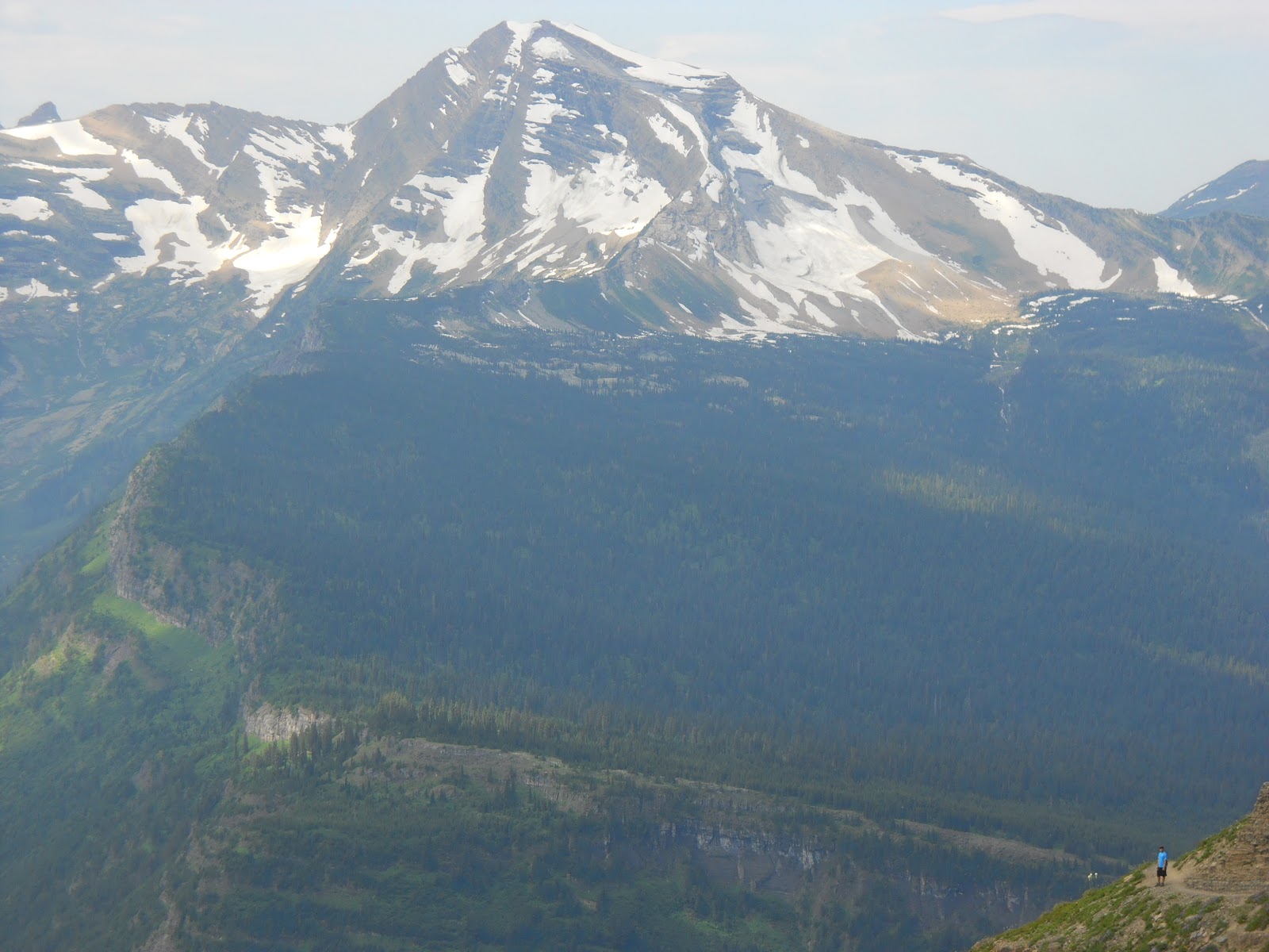
The last picture was taken by my brother at the top of the Ptarmigan Tunnel Trail. Unfortunately, we were unable to get a picture of the bear as my camera was in my pack and we were too busy watching the bear.